
")


")
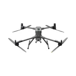

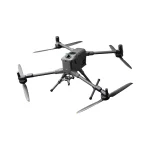
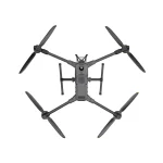

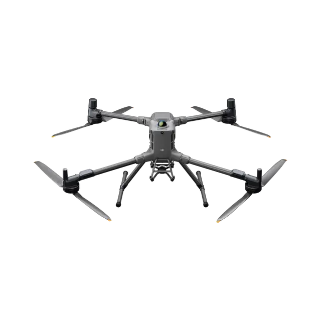
DJI Matrice 400 (Call For Price)
Original price was: 1.00৳ .0.00৳ Current price is: 0.00৳ .
- 1 Year Dji Official Free Replacement Warranty
- Extended Flight Time, Dust and Water Resistant
- Upgraded Payload Capacity and Multi-Payload Support
- Power-Line-Level Obstacle Sensing, Safer Flight
- Enhanced Intelligence and Efficiency
- Easier Automated Operations
- 1-Year DJI Official Warranty
Payment Methods:
DJI Matrice 400, the enterprise flagship drone platform, boasts an impressive 59-minute flight time, a payload capacity of up to 6 kg, and integrated rotating LiDAR and mmWave radar for power-line-level obstacle sensing. It also supports the O4 Enterprise Enhanced Video Transmission and Airborne Relay Video Transmission, ensuring safer handling and easier operations. Combining Smart Detection with visible and thermal imaging, AR projection, ship-based takeoff/landing, and advanced automation, Matrice 400 excels in emergency response, power inspections, mapping, and AEC.
Extended Flight Time, High Speed Performance
Matrice 400’s flight capabilities are outstanding, offering up to 59 minutes of forward flight time even with a payload, and up to 53 minutes of hovering duration. These capabilities make it a reliable tool for long-duration and continuous operations such as search and rescue, firefighting, and large-scale mapping. It can also avoid large obstacles like buildings and mountains at flight speeds of up to 25 m/s.
Multi-Payload, Multi-Scene
Matrice 400’s strong payload capacity allows it to easily meet the demands of a wide range of applications. With a maximum payload capacity of 6 kg, Matrice 400 supports seamless switching between a single downward gimbal and a dual downward gimbal. It also features a third gimbal connector on the underside for additional flexibility. The aircraft is equipped with 4 external E-Port V2 ports , enabling simultaneous mounting of up to 7 payloads.
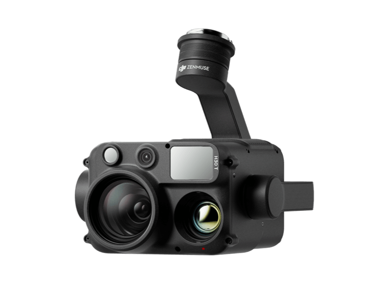
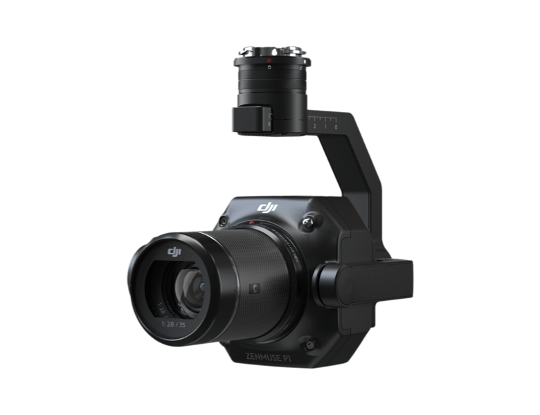
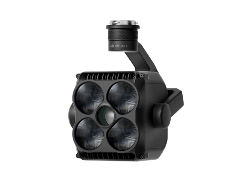
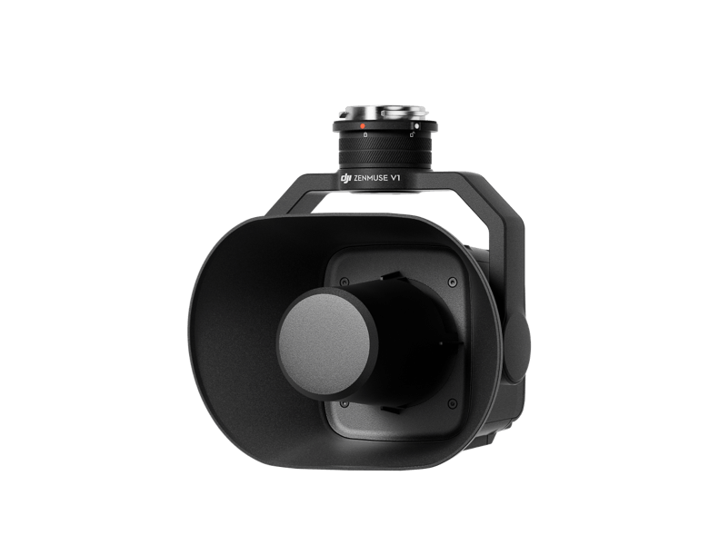
Depending on the task, Matrice 400 can be equipped with the Zenmuse H30 Series, L2, P1, S1 Spotlight, V1 Speaker, Manifold 3, or third-party payloads, thereby expanding its capabilities and unlocking the full potential of the DJI ecosystem.

Flight Time
Estimate the Matrice 400’s flight time based on payload configuration.
Safe and Reliable Flight
Safe and Reliable Flight
Matrice 400 has a protection rating of IP55, allowing it to operate reliably in challenging conditions including heavy dust or rain. It also maintains stable performance across temperatures from -20° to 50° C (-4° to 122° F), delivering consistent results in both hot and cold conditions.
Power-Line-Level Obstacle Sensing
The Matrice 400’s advanced obstacle sensing system integrates rotating LiDAR, high-precision mmWave radar, and full-color low-light fisheye vision sensors, pushing detection capabilities to unprecedented levels. The system detects even small obstacles like high-voltage power lines across mountainous terrain — even in darkness. It can penetrate rain and fog to sense its surroundings, providing enhanced safety in challenging weather conditions.
Robust Video Transmission
O4 Enterprise Enhanced Video Transmission System
Thanks to the ten-antenna system on the aircraft and the high-gain phased array antenna system on the remote controller, the O4 Enterprise Enhanced Video Transmission System can achieve image transmission up to 40 km.
Matrice 400 also supports the sub2G frequency band, and when equipped with two DJI Cellular Dongle 2, it can automatically switch to the better available carrier network, providing a more stable signal even in urban interference environments or remote regions.

Airborne Relay Video Transmission
Matrice 400 has a built-in video transmission relay module. With this setup, one Matrice 400 can serve as a relay drone, flying high to provide relay signals for another Matrice 400 operating at a greater distance. This capability significantly extends the transmission range, making it ideal for search and rescue tasks as well as inspections in mountainous areas.

Aircraft Fusion Positioning
The omnidirectional sensing performance brought by rotating LiDAR, high-precision mmWave radar, and full-color low-light fisheye vision sensors provides Matrice 400 with strong positioning capabilities. It can fly stably close to glass-facade buildings or wind turbine blades and safely return from building edges, mountain bases, or bridge sides even when the return point has not been updated.

Full-Color Vision Assist
The four full-color low-light fisheye vision sensors on the aircraft provide Full-Color Vision Assist to ensure safer flight.

Enhanced Intelligence and Efficiency
Smart Detection
With Zenmuse H30 Series’ visible and thermal imaging, Matrice 400 can detect vehicles, vessels, and subjects during search and rescue operations or routine flights. It also supports switching to other models, enabling the expansion of application scenarios. Additionally, it supports high-res grid photos and features powerful tracking capabilities.

Smart AR Projection
Power Line AR
During tasks such as power grid inspection, the obstacle sensing system automatically detects frontal wire obstacles and displays easily recognisable AR lines on the remote controller’s screen, making the surrounding environment clear at a glance and ensuring safer flight.
Map View AR
When operating during the day or night in urban regions, the remote controller can display the names of buildings and landmarks in real-time, marking core roads with prominent lines.
AR Flight Waypoint
Real-time route preview is available for the drone during RTH, obstacle sensing, and FlyTo operations. During landing, the AR Aircraft Shadow can be displayed to help operators confirm the landing location.
Live Annotations
Without modeling, you can mark points on the remote controller screen to obtain subject locations, draw lines to measure distances between multiple points, and outline areas to calculate their size. Measurement results can be synchronized to the DJI FlightHub 2 to enhance team efficiency.

Real-Time Terrain Follow
Matrice 400 supports Real-Time Terrain Follow flight in any horizontal direction. This feature can be enabled during both manual flight and automated flight routes, ensuring stable relative height to the ground.
During large-scale search and rescue operations, the size of ground subjects can be kept consistent on the remote controller screen, reducing the need for frequent zoom adjustments and improving efficiency. During mapping missions, a consistent ground sampling distance (GSD) can be maintained to obtain high-precision mapping data.

Takeoff and Landing on Ships
To address the needs of offshore operations such as maritime patrol and wind turbine inspection, Matrice 400 is equipped with the capability to take off from and land on ships, supporting takeoff from stationary vessels and landing on moving vessels. By detecting landing point patterns on the deck, it can achieve safe and precise landings.

Intelligent Flight Modes
Cruise
Activate cruise control mode to pilot the drone in a specific direction without constantly pressing the control sticks, making long-distance flights or linear inspections easier.
FlyTo
In emergencies or disasters, the drone can automatically adjust its flight path and speed based on the surrounding environment, allowing it to reach a designated location without manual adjustments.
Smart Track
Smart Track allows for precise subject positioning and automatic zoom adjustments, allowing you to switch between subjects easily. It can automatically reacquire a subject even if obscured briefly.
POI
POI enables continuous observation and 3D modeling of buildings while orbiting a designated area, greatly enhancing the efficiency of fixed-point observation and modeling tasks.

Easier Automated Operations
Power Line Follow With Zenmuse L2
When equipped with the L2 LiDAR system, Matrice 400 can perform automated power transmission and distribution line following flights. It uses the rotating LiDAR to detect obstacles in real time and automatically bypasses crossing lines.

Slope Route & Geometric Route
Matrice 400 supports the planning and execution of slope and geometric routes via DJI Pilot 2 or DJI FlightHub 2. Whether conducting detailed aerial surveys of building facades, slopes, or other inclined surfaces, or collecting mapping data of individual buildings or structures, Matrice 400 can quickly plan slope or geometric routes to efficiently acquire high-precision data.
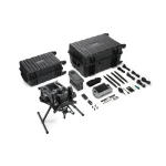
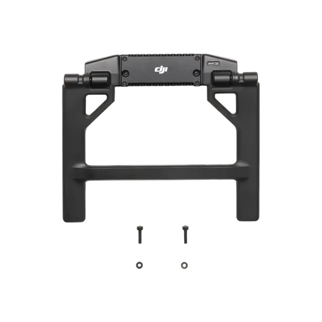
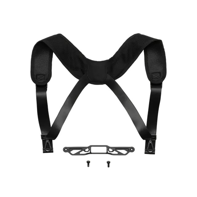
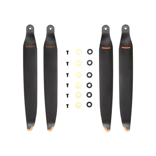
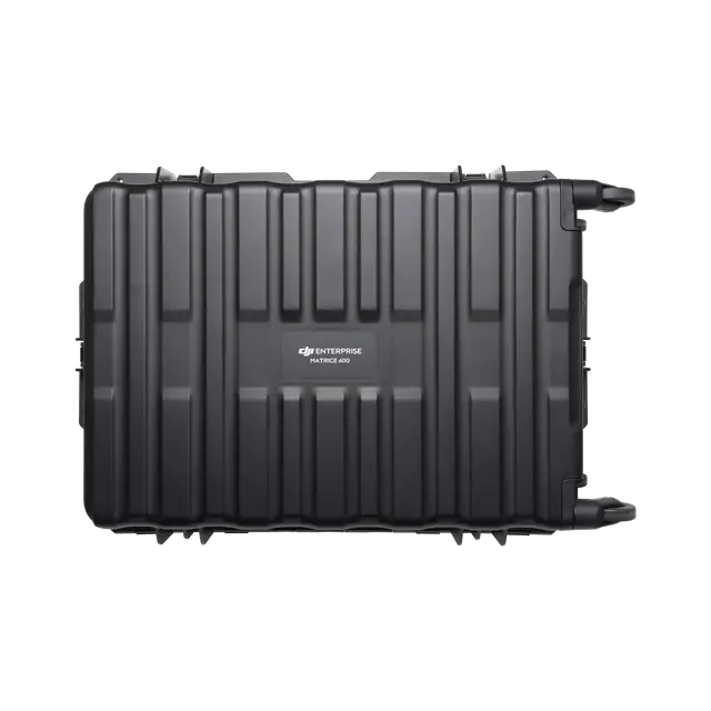
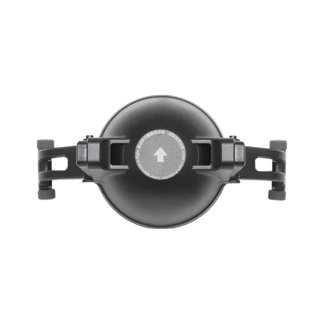
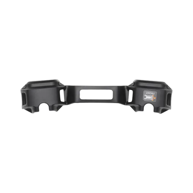
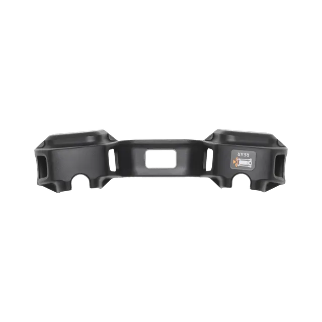
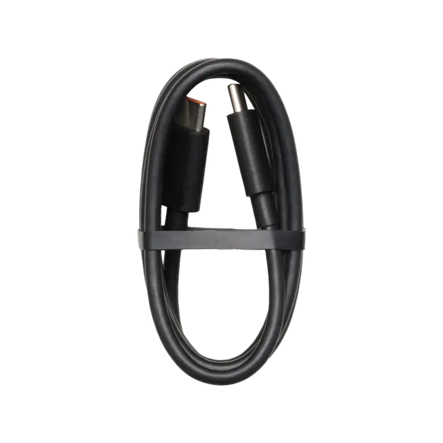
What’s Included


Specifications
| Aircraft | |
|---|---|
|
Takeoff Weight (with propellers)
|
The actual product weight may vary due to differences in batch materials and external factors.
|
|
Max Takeoff Weight
|
|
|
Dimensions
|
Maximum dimensions excluding propellers.Aircraft carrying case dimensions: 779×363×528 mm (L×W×H)
|
|
Max Payload
|
The 6 kg payload is measured at the third gimbal connector under sea level conditions. Payload capacity decreases as altitude increases. For details, refer to the official user manual. |
|
Propeller Size
|
|
|
Diagonal Wheelbase
|
|
|
Max Ascent Speed
|
|
|
Max Descent Speed
|
|
|
Max Horizontal Speed (at sea level, no wind)
|
|
|
Max Takeoff Altitude
|
|
|
Max Flight Time (no wind)
|
Measured with the aircraft flying forward at a constant speed of 10 m/s in a windless environment at sea level, carrying only the H30T (total weight 10,670 g), and from 100% battery level until 0%. Data is for reference only. Actual experience may vary depending on the environment, usage, and firmware version. |
|
Max Hover Time (no wind)
|
Measured with the aircraft hovering in a windless environment at sea level, carrying only the H30T (total weight 10,670 g), and from 100% battery level until 0%. Data is for reference only. Actual usage time may vary depending on the flight mode, accessories, and environment. |
|
Max Flight Distance (no wind)
|
Measured by the aircraft flying forward at a constant speed of 17 m/s in a windless environment at sea level, without external payloads, and from 100% battery level until 0%. Actual experience may vary depending on the environment, usage, and firmware version. |
|
Max Wind Speed Resistance
|
Max wind speed resistance during takeoff and landing. |
|
Max Yaw Angular Velocity
|
|
|
Max Pitch Angle
|
|
|
Operating Temperature
|
|
|
Global Navigation Satellite System (GNSS)
|
* GLONASS is supported only when the RTK module is enabled. Equipped with standard airborne ADS-B In receiver and dual antennas, supporting reception up to 20 km. |
|
Hovering Accuracy Range (with moderate or no wind)
|
Horizontal:
±0.3 m (with vision positioning) ±0.5 m (with satellite positioning) ±0.1 m (with RTK positioning) |
|
RTK GNSS Accuracy
|
|
|
RTK Heading
|
|
|
Airborne ADS-B In
|
|
|
Internal Storage
|
|
|
Ports
|
|
|
Propeller Model
|
|
|
Beacon
|
|
|
Ingress Protection Rating
|
The rating is not permanently effective and may decrease due to product wear and tear. |
| Gimbal | |
|
Maximum Payload for Single Gimbal Connector
|
If exceeds, the gimbal damper lifespan will decrease from 1000 hours to 400 hours. |
|
Maximum Payload for Dual Gimbal Connector
|
|
|
Maximum Payload for Third Gimbal Connector
|
|
| Sensing | |
|
Sensing Type
|
Horizontal rotating LiDAR, upper LiDAR and downward 3D infrared range sensor Six-direction mmWave radar |
|
Forward
|
|
|
Backward
|
|
|
Lateral
|
|
|
Downward
|
|
|
Operating Environment
|
Downward:
The ground has rich textures and sufficient lighting conditions*, with a diffuse reflection surface and a reflectivity greater than 20% (such as walls, trees, people, etc.).* Sufficient lighting conditions refer to an illuminance not lower than that of a nighttime city light scene. |
|
Rotating LiDAR
|
|
|
Upper LiDAR (3D ToF)
|
|
|
Downward 3D Infrared Range Sensor
|
|
|
mmWave Radar
|
The mmWave radar function is unavailable in some countries/regions.
|
| FPV Camera | |
|
Resolution
|
|
|
Field of View (FOV)
|
|
|
Frame Rate
|
|
|
Night Vision
|
|
| Video Transmission | |
|
Video Transmission System
|
|
|
Live View Quality
|
|
|
Operating Frequency and Transmitter Power (EIRP)
|
Operating frequency allowed varies among countries and regions. Refer to local laws and regulations for more information.
|
|
Max Transmission Distance (unobstructed, free of interference)
|
Measured in an unobstructed environment free of interference. The above data shows the farthest communication range for one-way, non-return flights under each standard. During your flight, please pay attention to RTH reminder on the DJI Pilot 2 app.
|
|
Max Transmission Distance (with interference)
|
Data is tested under FCC standard in unobstructed environments of typical interference. Only to serve as a reference and provides no guarantee as to the actual flight distance.
|
|
Max Download Speed
|
The above data was measured under conditions where the aircraft and remote controller were in close proximity without interference.
|
|
Antenna
|
Operating Mode: 2T4R
|
|
Others
|
|
| Battery | |
|
Model
|
|
|
Capacity
|
|
|
Standard Voltage
|
|
|
Max Charging Voltage
|
|
|
Cell Type
|
|
|
Energy
|
|
|
Weight
|
|
|
Charging Temperature
|
|
|
Discharging Temperature
|
|
|
Battery Heating
|
|
|
Discharge Rate
|
|
|
Max Charging Power
|
|
|
Low-Temperature Charging
|
|
|
Cycle Count
|
|
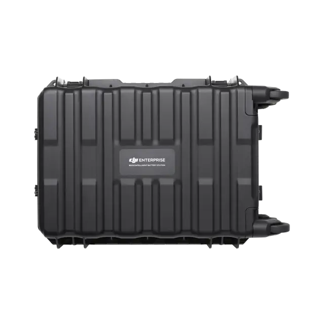
| Intelligent Battery Station | |
|
Model
|
|
|
Net Weight
|
|
|
Dimensions
|
|
|
Supported Batteries
|
|
|
Operating Temperature
|
|
|
Input
|
|
|
Output
|
WB37 Battery Interface:
100-240 V: Approx. 52 WUSB-C: 5.0 V 3.0 A, 9.0 V 3.0 A, 12.0 V 3.0 A, 15.0 V 3.0 A, 20.0 V 3.25 A |
|
Number of Charging Channels
|
|
|
Charging Mode
|
|
|
Charging Time
|
Charging time is measured in a test environment with a temperature of 25° C.
|
| DJI RC Plus 2 Enterprise Enhanced | |
|
Video Transmission System
|
|
|
Max Transmission Distance (unobstructed, free of interference)
|
Measured in an unobstructed environment free of interference. The above data shows the farthest communication range for one-way, non-return flights under each standard. During your flight, please pay attention to RTH reminder on the DJI Pilot 2 app.
|
|
Video Transmission Operating Frequency and Transmitter Power (EIRP)
|
Operating frequency allowed varies among countries and regions. Refer to local laws and regulations for more information.
|
|
Antenna
|
|
|
Enhanced Transmission
|
|
|
Wi-Fi Protocol
|
|
|
Wi-Fi Operating Frequency
|
5.2 and 5.8GHz frequencies are prohibited in some countries. In some countries, the 5.2GHz frequency is only allowed for use in indoor.
|
|
Wi-Fi Transmitter Power (EIRP)
|
|
|
Bluetooth Protocol
|
|
|
Bluetooth Operating Frequency
|
|
|
Bluetooth Transmitter Power (EIRP)
|
|
|
Screen Resolution
|
|
|
Screen Size
|
|
|
Screen Frame Rate
|
|
|
Brightness
|
|
|
Touchscreen Control
|
|
|
Built-in Battery
|
|
|
External Battery
|
|
|
Charging Type
|
|
|
Storage Capacity
|
|
|
Charging Time
|
When remote controller is powered off and using a standard DJI charger. |
|
Internal Battery Runtime
|
|
|
External Battery Runtime
|
|
|
Output Port
|
|
|
Indicators
|
|
|
Speaker
|
|
|
Audio
|
|
|
Operating Temperature
|
|
|
Storage Temperature
|
|
|
Charging Temperature
|
|
|
Supported Aircraft Model
|
|
|
Global Navigation Satellite System
|
|
|
Dimensions
|
Width including external antenna folded, thickness including handle and controller sticks. |
|
Weight
|
|
|
Model
|
|
|
System Version
|
|
|
External Interfaces
|
|
|
Accessories
|
|
| Supported Products | |
|---|---|
|
DJI Products Compatible With Matrice 400
|
|
| Weight | 0.1 kg |
|---|
Related products
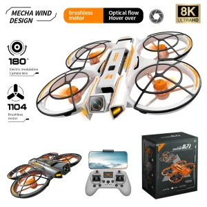
A21 pro Gaming Version
In stock
Original price was: 8,500.00৳ .5,990.00৳ Current price is: 5,990.00৳ .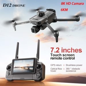
D12 4k camera professional drone
In stock
Original price was: 52,000.00৳ .44,500.00৳ Current price is: 44,500.00৳ .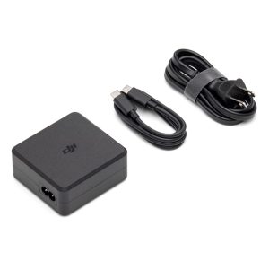
DJI 100W USB-C Power Adapter
In stock
Original price was: 15,000.00৳ .9,450.00৳ Current price is: 9,450.00৳ .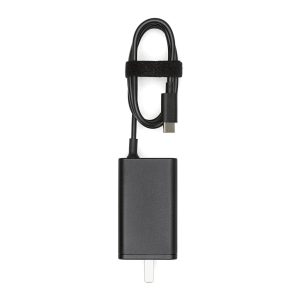
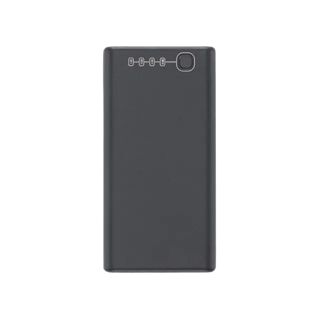
DJI 65W Portable Charger
In stock
Original price was: 6,500.00৳ .4,500.00৳ Current price is: 4,500.00৳ .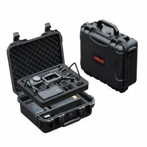
DJI Action 6 startrc Double-layer Hard Case
In stock
Original price was: 6,000.00৳ .4,300.00৳ Current price is: 4,300.00৳ .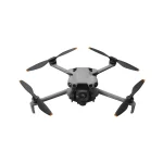


Reviews
There are no reviews yet.